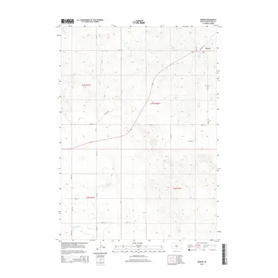
2015 Map of Okreek
USGS Topo · Published 2015About this map
Okreek serves as the primary hub of this landscape in the Antelope Segment of Todd County, situated in the high plains of South Dakota. The topography is defined by the drainage of Butte Cr in the northwest, which cuts through the upland terrain. The map documents the rural road network and the public land survey system divisions of townships T39N R27W, T39N R26W, T38N R27W, and T38N R26W. This modern survey provides a clear view of the physical layout of the community and the surrounding rangeland before any further contemporary development, making it an essential reference for understanding the modern spatial arrangement of this portion of the Rosebud Indian Reservation.
Find a feature on this map
2 named features on this map. Tap any name to fly to it.
Don’t see what you’re looking for? This feature index may not catch every label — zoom into the map to look around manually.
Map Details
Editions of this 2015 Okreek Map
This is the sole edition of this map. No revisions or reprints were ever made.
Other maps of this area

1955 · Martin
USGS Topo · 1:250,000

1958 · Martin
USGS Topo · 1:250,000

1982 · Mission NE
USGS Topo · 1:24,000

1982 · Olsonville
USGS Topo · 1:24,000

1982 · Hidden Timber
USGS Topo · 1:24,000

1982 · Okreek
USGS Topo · 1:25,000

1982 · Okreek SE
USGS Topo · 1:24,000
1982 · Mission SE
USGS Topo · 1:24,000

1982 · Mosher
USGS Topo · 1:25,000
1982 · Hidden Timber NE
USGS Topo · 1:24,000