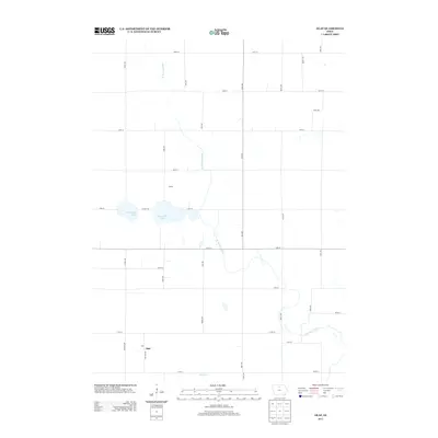
2013 Map of Olaf
USGS Topo · Published 2013About this map
The W Br Iowa River meanders southward through this rural section of Wright County, defining the drainage patterns of a landscape dominated by agricultural grid-lines and scattered water bodies. The small settlement of Olaf serves as a primary point of reference in the southwest, while the locality of Bailey sits just north of the notable glacial depressions of East Twin Lake and West Twin Lake. These lakes, bisected by Co HWY-b63, represent significant hydrologic features in an otherwise strictly partitioned terrain. A network of rural avenues and numbered streets, such as Palm Ave and 120th St, provides access to the surrounding farmsteads. In the southeast, Eagle Cr and the winding river channel intersect, illustrating the subtle elevation changes that guide the region's surface water toward larger basins.
Find a feature on this map
30 named features on this map. Tap any name to fly to it.
Don’t see what you’re looking for? This feature index may not catch every label — zoom into the map to look around manually.
Map Details
Editions of this 2013 Olaf Map
This is the sole edition of this map. No revisions or reprints were ever made.
Other maps of this area

1954 · Mason City
USGS Topo · 1:250,000

1954 · Waterloo
USGS Topo · 1:250,000

1955 · Waterloo
USGS Topo · 1:250,000

1957 · Mason City
USGS Topo · 1:250,000

1958 · Mason City
USGS Topo · 1:250,000

1972 · Kanawha SE
USGS Topo · 1:24,000

1972 · Cornelia
USGS Topo · 1:24,000

1972 · Kanawha
USGS Topo · 1:24,000

1972 · Olaf
USGS Topo · 1:24,000

1972 · Belmond
USGS Topo · 1:24,000