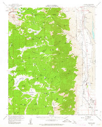
1956 Map of Olancha
USGS Topo · Published 1963About this map
Cottonwood Creek flows from the high Sierra down toward the dry basin of Owens Lake, illustrating the complex water management systems of the mid-20th century. The presence of the Los Angeles Aqueduct and the Cottonwood Power Plant highlights the region's role in supporting distant urban growth. Along the eastern shore, industrial sites like Bartlett and various Soda Evaporator facilities mark the mineral extraction economy of the era.
Find a feature on this map
91 named features on this map. Tap any name to fly to it.
Don’t see what you’re looking for? This feature index may not catch every label — zoom into the map to look around manually.
Map Details
Editions of this 1956 Olancha Map
4 editions found

Other maps of this area

1905 · Olancha
USGS Topo · 1:125,000

1907 · Olancha
USGS Topo · 1:125,000

1907 · Mt. Whitney
USGS Topo · 1:125,000

1908 · Ballarat
USGS Topo · 1:250,000

1913 · Ballarat
USGS Topo · 1:250,000

1919 · Mt. Whitney
USGS Topo · 1:125,000

1937 · Mt. Whitney
USGS Topo · 1:125,000

1948 · Death Valley
USGS Topo · 1:250,000

1948 · Fresno
USGS Topo · 1:250,000

1950 · New York Butte
USGS Topo · 1:62,500