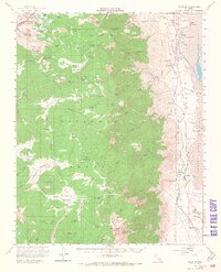
1956 Map of Olancha
USGS Topo · Published 1968About this map
Owens Lake sits at the edge of the high Sierra, its eastern shore dominated by industrial evaporation works and the Southern Pacific rail line. This 1950s survey captures the complex water management systems of the era, from the Los Angeles Aqueduct snaking along the foothills to the Cottonwood Power Plant and its associated Powerhouse. The landscape transitions sharply from the valley floor settlements like Cartago and Olancha to the high alpine meadows of Sequoia National Park.
Find a feature on this map
92 named features on this map. Tap any name to fly to it.
Don’t see what you’re looking for? This feature index may not catch every label — zoom into the map to look around manually.
Map Details
Editions of this 1956 Olancha Map
4 editions found

Other maps of this area

1905 · Olancha
USGS Topo · 1:125,000

1907 · Olancha
USGS Topo · 1:125,000

1907 · Mt. Whitney
USGS Topo · 1:125,000

1908 · Ballarat
USGS Topo · 1:250,000

1913 · Ballarat
USGS Topo · 1:250,000

1919 · Mt. Whitney
USGS Topo · 1:125,000

1937 · Mt. Whitney
USGS Topo · 1:125,000

1948 · Death Valley
USGS Topo · 1:250,000

1948 · Fresno
USGS Topo · 1:250,000

1950 · New York Butte
USGS Topo · 1:62,500