2024 Map of Olanta
USGS Topo · Published 2024About this map
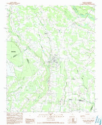
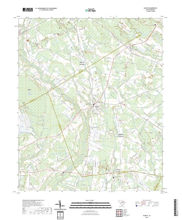
Olanta serves as the central hub of this South Carolina landscape, situated at the junction of several key roads near the confluence of Cypress Branch and the Lynches River drainage. The map reveals a high concentration of small family and community burial grounds, such as Rush Cem, Bethany Cem, and the Bethel Church Graveyard, which reflect the deep-rooted local history of Florence and Sumter counties. Several outlying hamlets like Shiloh and Norwood Crossroad are visible, connected by a network of rural routes such as Yarborough Hwy and Mount Zion Rd.
Find a feature on this map
111 named features on this map. Tap any name to fly to it.
Don’t see what you’re looking for? This feature index may not catch every label — zoom into the map to look around manually.
Map Details
Editions of this 2024 Olanta Map
This is the sole edition of this map. No revisions or reprints were ever made.