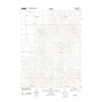
2013 Map of Old Baldy
USGS Topo · Published 2013About this map
Old Baldy rises as a distinct topographical feature in this corner of Yuma County, marking a landscape defined by its high plains character and organized agricultural grid. The map illustrates a modern rural economy where specialized operations like the Buffalo Grass Hog Farm sit alongside extensive sections of open land. The area is intersected by a systematic network of county routes, including Co Road 55.5 and Co Road 54, which provide the primary infrastructure for this sparsely populated region. This survey captures the precise township and range boundaries that have governed land division here for generations, reflecting the enduring legacy of the Public Land Survey System in eastern Colorado. The terrain is characterized by subtle elevation changes and drainage patterns that dictate the placement of roads like Co Road V and Co Road U as they navigate the dry plains environment.
Find a feature on this map
22 named features on this map. Tap any name to fly to it.
Don’t see what you’re looking for? This feature index may not catch every label — zoom into the map to look around manually.
Map Details
Editions of this 2013 Old Baldy Map
This is the sole edition of this map. No revisions or reprints were ever made.
Other maps of this area
1954 · Sterling
USGS Topo · 1:250,000
1958 · Sterling
USGS Topo · 1:250,000
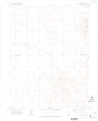
1971 · Fiddler Peak
USGS Topo · 1:24,000
1971 · Wauneta NE
USGS Topo · 1:24,000
1971 · Clarkville NE
USGS Topo · 1:24,000
1971 · Yuma NE
USGS Topo · 1:24,000
1971 · Wauneta
USGS Topo · 1:24,000
1971 · Eckley NE
USGS Topo · 1:24,000
1971 · Clarkville SE
USGS Topo · 1:24,000
1971 · Old Baldy
USGS Topo · 1:24,000