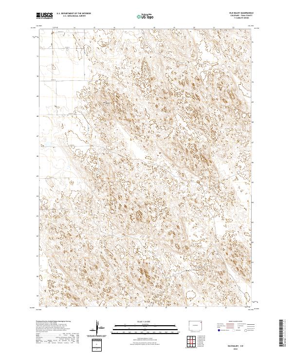
2022 Map of Old Baldy
USGS Topo · Published 2022About this map
Old Baldy rises as a prominent landmark in this northeastern corner of the High Plains, where the terrain is defined by a dense network of closed depressions and sandy knolls. The landscape is structured by a precise grid of rural thoroughfares, including Co Rd 55.5, Co Rd 55, and Co Rd T, which reflect the region's agricultural partitioning. This area of Yuma County demonstrates the persistence of the Public Land Survey System, with township and range lines like t5n r46w and t4n r45w organizing the sparse settlement. The lack of surface water and the concentration of roads in the northwest corner suggest a geography where activity is closely tied to accessible transportation corridors, while the remainder of the territory remains open and largely undeveloped.
Find a feature on this map
16 named features on this map. Tap any name to fly to it.
Don’t see what you’re looking for? This feature index may not catch every label — zoom into the map to look around manually.
Map Details
Editions of this 2022 Old Baldy Map
This is the sole edition of this map. No revisions or reprints were ever made.
Other maps of this area

1954 · Sterling
USGS Topo · 1:250,000

1958 · Sterling
USGS Topo · 1:250,000

1971 · Fiddler Peak
USGS Topo · 1:24,000

1971 · Wauneta NE
USGS Topo · 1:24,000

1971 · Clarkville NE
USGS Topo · 1:24,000

1971 · Yuma NE
USGS Topo · 1:24,000

1971 · Wauneta
USGS Topo · 1:24,000

1971 · Eckley NE
USGS Topo · 1:24,000

1971 · Clarkville SE
USGS Topo · 1:24,000

1971 · Old Baldy
USGS Topo · 1:24,000