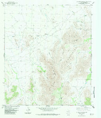
1983 Map of Old Blue Mountain
USGS Topo · Published 1984About this map
The Glass Mountains dominate this 1983 survey of Brewster County, anchored by the prominent elevations of Old Blue Mountain and Little Blue Mountain. The landscape is defined by its arid canyon systems, including Spring Canyon, Jail Canyon, and Gilliland Canyon, which cut through the high desert terrain. Human presence in this environment is marked by essential water infrastructure and livestock operations, such as Esterwood Ranch and the Wallace Windmill. These features indicate the practical requirements of ranching in West Texas during the late 20th century.
Find a feature on this map
21 named features on this map. Tap any name to fly to it.
Don’t see what you’re looking for? This feature index may not catch every label — zoom into the map to look around manually.
Map Details
Editions of this 1983 Old Blue Mountain Map
2 editions found
Other maps of this area

1923 · Hess Canyon
USGS Topo · 1:62,500

1923 · Altuda
USGS Topo · 1:62,500

1929 · Hovey
USGS Topo · 1:125,000

1954 · Fort Stockton
USGS Topo · 1:250,000

1958 · Fort Stockton
USGS Topo · 1:250,000

1973 · Fort Stockton
USGS Topo · 1:250,000

1980 · Cave Mesa
USGS Topo · 1:24,000

1980 · Hovey
USGS Topo · 1:24,000
1980 · Hovey SW
USGS Topo · 1:24,000
1983 · Gilliland Peak
USGS Topo · 1:24,000