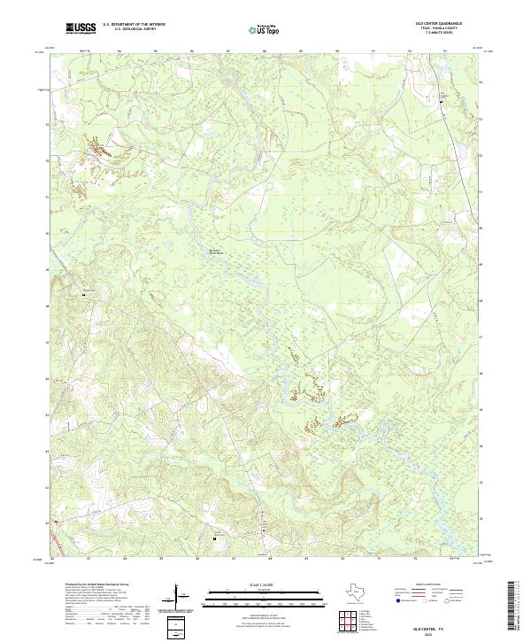
2022 Map of Old Center
USGS Topo · Published 2022About this map
Sabine River dominates the central landscape of this Panola County survey, winding through a dense network of wetlands and oxbows, most notably at the sharp turn of Buzzard-Roost-Bend. The terrain is defined by its drainage systems, where numerous tributaries like Sixmile Cr, Murvaul Cr, and Wilkerson Cr feed into the main river channel. This area of East Texas maintains a rural, dispersed character, with the road network largely composed of county roads and farm-to-market routes like FM 699 and FM 31. For those tracing local heritage, the map identifies several established burying grounds serving the surrounding communities, including Old Center Cem, Social Point Cem, and Old Prospect Cem. The placement of these cemeteries, often near the intersections of local connectors, provides a clear indication of the historical settlement patterns in this river-bottom region.
Find a feature on this map
42 named features on this map. Tap any name to fly to it.
Don’t see what you’re looking for? This feature index may not catch every label — zoom into the map to look around manually.
Map Details
Editions of this 2022 Old Center Map
This is the sole edition of this map. No revisions or reprints were ever made.
Other maps of this area

1945 · Socagee Bayou
USGS Topo · 1:62,500

1953 · Palestine
USGS Topo · 1:250,000

1956 · Tyler
USGS Topo · 1:250,000

1956 · Deadwood
USGS Topo · 1:62,500

1957 · Palestine
USGS Topo · 1:250,000

1958 · Center
USGS Topo · 1:62,500

1958 · Timpson
USGS Topo · 1:62,500

1958 · Carthage
USGS Topo · 1:62,500
1983 · River Hill
USGS Topo · 1:24,000
1983 · Logan
USGS Topo · 1:24,000