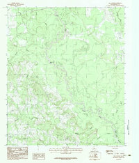
1983 Map of Old Center
USGS Topo · Published 1983About this map
Sabine River bottomlands dominate this section of Panola County, where the meandering waterway creates intricate oxbows and swampy lowlands like Coon Pond. The terrain transitions from these river basins into the wooded uplands surrounding settlements such as Old Center and Woods. A notable geographical feature is the sharp turn of the river at Buzzard Roost Bend, a landmark that underscores the unhurried, winding nature of the East Texas drainage system before it enters the northern reaches of the Toledo Bend Reservoir.
Find a feature on this map
14 named features on this map. Tap any name to fly to it.
Don’t see what you’re looking for? This feature index may not catch every label — zoom into the map to look around manually.
Map Details
Editions of this 1983 Old Center Map
This is the sole edition of this map. No revisions or reprints were ever made.
Other maps of this area

1945 · Socagee Bayou
USGS Topo · 1:62,500

1953 · Palestine
USGS Topo · 1:250,000

1956 · Tyler
USGS Topo · 1:250,000

1956 · Deadwood
USGS Topo · 1:62,500

1957 · Palestine
USGS Topo · 1:250,000

1958 · Center
USGS Topo · 1:62,500

1958 · Timpson
USGS Topo · 1:62,500

1958 · Carthage
USGS Topo · 1:62,500
1983 · River Hill
USGS Topo · 1:24,000
1983 · Logan
USGS Topo · 1:24,000