
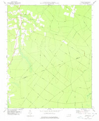
2013 Map of Old Ford
USGS Topo · Published 2013About this map
Old Ford and its surrounding crossroads serve as the primary hubs in this agricultural pocket of Beaufort County. The landscape is heavily defined by a dense network of slow-moving water bodies, including Bear Grass Swamp and Gum Swamp, which influenced the placement of early settlements and road alignments. Established rural junctions such as Batts Crossroads and Stallings Crossroads highlight the historical importance of these meeting points for the farming community. Farther north, the community of Smithwick sits near the headwaters of Smithwick Cr. The map details numerous family-named roads, such as Arthur Corey Rd and Wilbur Roberson Rd, which provide valuable clues for genealogists tracking local landownership and lineage in this coastal plain region.
Find a feature on this map
66 named features on this map. Tap any name to fly to it.
Don’t see what you’re looking for? This feature index may not catch every label — zoom into the map to look around manually.
Map Details
Editions of this 2013 Old Ford Map
This is the sole edition of this map. No revisions or reprints were ever made.
Other maps of this area

1901 · Williamston
USGS Topo · 1:62,500

1902 · Williamston
USGS Topo · 1:62,500

1903 · Chocowinity
USGS Topo · 1:62,500

1905 · Chocowinity
USGS Topo · 1:62,500

1943 · Plymouth
USGS Topo · 1:125,000

1951 · Bunyan
USGS Topo · 1:24,000

1951 · Washington
USGS Topo · 1:24,000

1953 · Rocky Mount
USGS Topo · 1:250,000

1954 · Rocky Mount
USGS Topo · 1:250,000
1978 · Farmlife
USGS Topo · 1:24,000