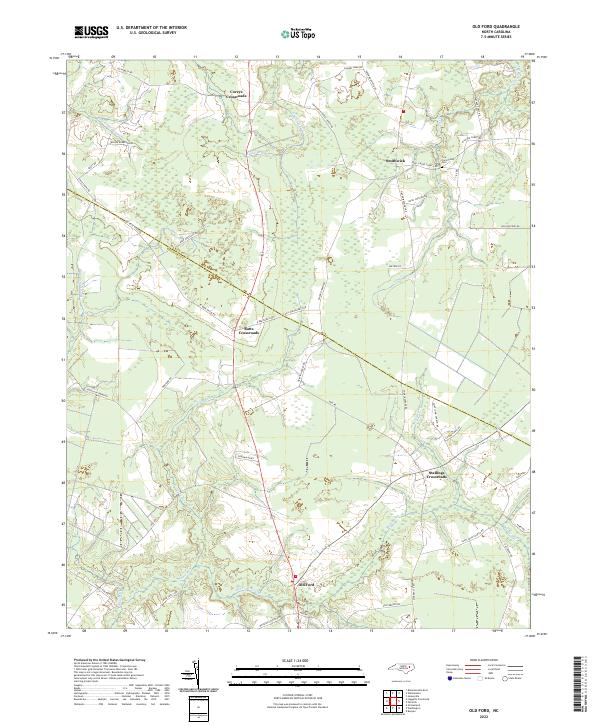
2022 Map of Old Ford
USGS Topo · Published 2022About this map
Old Ford and a series of rural hubs define this corner of Beaufort County, where the coastal plain is deeply etched by a network of slow-moving waters and named swamps. The map highlights a settlement pattern anchored at significant intersections, including Batts Crossroads, Coreys Crossroads, and Stallings Crossroads. These junctions connect timberlands and agricultural fields through a dense web of local routes like W Bear Grass Rd and Saint John Church Rd.
Find a feature on this map
57 named features on this map. Tap any name to fly to it.
Don’t see what you’re looking for? This feature index may not catch every label — zoom into the map to look around manually.
Map Details
Editions of this 2022 Old Ford Map
This is the sole edition of this map. No revisions or reprints were ever made.
Other maps of this area

1901 · Williamston
USGS Topo · 1:62,500

1902 · Williamston
USGS Topo · 1:62,500

1903 · Chocowinity
USGS Topo · 1:62,500

1905 · Chocowinity
USGS Topo · 1:62,500

1943 · Plymouth
USGS Topo · 1:125,000

1951 · Bunyan
USGS Topo · 1:24,000

1951 · Washington
USGS Topo · 1:24,000

1953 · Rocky Mount
USGS Topo · 1:250,000

1954 · Rocky Mount
USGS Topo · 1:250,000
1978 · Farmlife
USGS Topo · 1:24,000