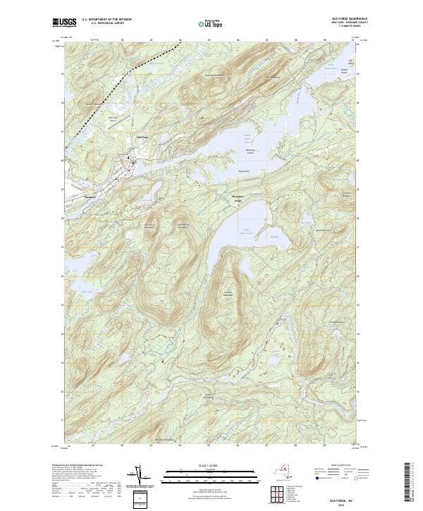
2023 Map of Old Forge
USGS Topo · Published 2023About this map
Old Forge sits at the heart of this landscape, where the Middle Branch Moose River connects the western reach of the Fulton Chain Lakes. The settlement patterns here are defined by the water and the rising Adirondack peaks, with the village layout extending from Lakeside Ter and Crosby Blvd toward the Old Forge Airport. To the southwest, the hamlet of Thendara serves as a secondary hub near Nicks Lake, while more isolated developments like Mountain Lodge are tucked between Little Moose Lake and the slopes of McCauley Mountain. The geography is characterized by a dense network of high-elevation water bodies and interconnected streams, including Limekiln Creek and the South Branch Moose River. Significant local landmarks for researchers include Riverview Cem and the trail systems like the Old Indian Trl and Tobie Trl, which reflect the region's long-standing identity as a center for forest recreation and mountain transit.
Find a feature on this map
96 named features on this map. Tap any name to fly to it.
Don’t see what you’re looking for? This feature index may not catch every label — zoom into the map to look around manually.
Map Details
Editions of this 2023 Old Forge Map
This is the sole edition of this map. No revisions or reprints were ever made.
Other maps of this area

1901 · Old Forge
USGS Topo · 1:62,500

1903 · Big Moose
USGS Topo · 1:62,500

1912 · Number Four
USGS Topo · 1:62,500

1912 · Mc Keever
USGS Topo · 1:62,500

1915 · Number Four
USGS Topo · 1:62,500

1950 · Utica
USGS Topo · 1:250,000

1954 · Old Forge
USGS Topo · 1:62,500

1954 · Big Moose
USGS Topo · 1:62,500

1957 · Utica
USGS Topo · 1:250,000
1957 · Number Four
USGS Topo · 1:62,500