
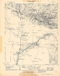
1921 Map of Old Glory
USGS Topo · Published 1921About this map
The San Luis Mts. and Sierra de Alamodel dominate this 1921 reconnaissance of the borderlands south of Tucson. This military survey documents a sparse network of working cattle ranches and mining claims during a period of increased border surveillance. Significant markers of the era include the Custom Guard Station and the Pajarito Ranger Station, while the Old Mission near Busani Ranch hints at much earlier Spanish-era settlement. Resource extraction is evident through the Old Glory Mine and Mejia Mine, along with the Inclan Ranch Old Mill. The landscape is defined by its water sources, from the Agua Caliente springs to various improvements like the El Silencio R. Well & Mud Tank, which were essential for survival in this arid territory.
Find a feature on this map
75 named features on this map. Tap any name to fly to it.
Don’t see what you’re looking for? This feature index may not catch every label — zoom into the map to look around manually.
Map Details
Editions of this 1921 Old Glory Map
2 editions found
Other maps of this area

1904 · Patagonia
USGS Topo · 1:125,000

1905 · Patagonia
USGS Topo · 1:125,000

1905 · Nogales
USGS Topo · 1:125,000

1920 · Arivaca
USGS Topo · 1:125,000

1922 · Agus Caliente
USGS Topo · 1:62,500

1933 · Calabasas
USGS Topo · 1:62,500

1939 · Tubac
USGS Topo · 1:62,500

1941 · Presumido Peak
USGS Topo · 1:62,500

1941 · Arivaca
USGS Topo · 1:62,500

1942 · Ruby
USGS Topo · 1:62,500