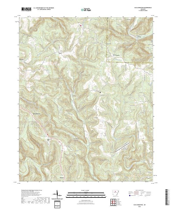
2024 Map of Old Lexington
USGS Topo · Published 2024About this map
Old Lexington and Old Botkinburg anchor this segment of the Ozark foothills, where the landscape is defined by a dense network of hollows and ridges at the border of Van Buren and Stone counties. The area exhibits a pattern of upland settlement connected by winding county roads, with prominent high points like Lexington Mtn and Holly Mountain rising above the drainage basins of Linn Creek and Pee Dee Creek. A notable geological landmark, the Natural Bridge of Arkansas, is situated south of Plant, highlighting the unique limestone or sandstone formations characteristic of this region.
Find a feature on this map
107 named features on this map. Tap any name to fly to it.
Don’t see what you’re looking for? This feature index may not catch every label — zoom into the map to look around manually.
Map Details
Editions of this 2024 Old Lexington Map
This is the sole edition of this map. No revisions or reprints were ever made.
Other maps of this area

1892 · Marshall
USGS Topo · 1:125,000

1892 · Mountain View
USGS Topo · 1:125,000

1894 · Mountain View
USGS Topo · 1:125,000

1894 · Marshall
USGS Topo · 1:125,000

1901 · Marshall
USGS Topo · 1:125,000

1956 · Russellville
USGS Topo · 1:250,000

1963 · Leslie
USGS Topo · 1:24,000

1964 · Russellville
USGS Topo · 1:250,000
1965 · Botkinburg
USGS Topo · 1:24,000
1965 · Scotland
USGS Topo · 1:24,000