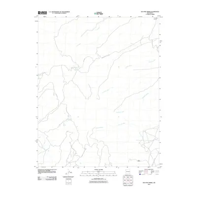
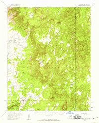
2010 Map of Old Pine Spring
USGS Topo · Published 2010About this map
Tocito Wash and a network of ephemeral drainages define this high-desert landscape within the Shiprock Agency. The area is characterized by scattered springs and strategic water sources such as Old Pine Spring and Old Sawmill Spring, which served as vital points for local inhabitants and travelers in this arid region of New Mexico. The geography is marked by significant topographical shifts, including the sharp descent into Porcupine Canyon in the northeast and the broad paths of To-nil-choni Wash and To-bil-hask-idi Wash. Transportation and access are facilitated by a series of Indian Service roads, including Indian Service Route 30 and Indian Service Route 342, which stitch together the remote reaches of the territory. The presence of Dodge Brothers in the southeast suggests a localized point of activity or habitation amidst the larger system of washes and canyons.
Find a feature on this map
14 named features on this map. Tap any name to fly to it.
Don’t see what you’re looking for? This feature index may not catch every label — zoom into the map to look around manually.
Map Details
Editions of this 2010 Old Pine Spring Map
This is the sole edition of this map. No revisions or reprints were ever made.
Other maps of this area

1889 · Chaco
USGS Topo · 1:250,000

1892 · Chaco
USGS Topo · 1:250,000

1892 · Canyon De Chelly
USGS Topo · 1:250,000

1953 · Sanostee
USGS Topo · 1:62,500

1954 · Shiprock
USGS Topo · 1:250,000

1955 · Sonsala Butte 1 SE
USGS Topo · 1:24,000
1955 · Sonsala Butte 1 NE
USGS Topo · 1:24,000
1955 · Sonsala Butte 4 NE
USGS Topo · 1:24,000
1955 · Sonsela Buttes
USGS Topo · 1:62,500
1955 · Lukachukai
USGS Topo · 1:62,500