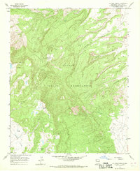
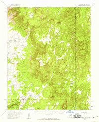
1966 Map of Old Pine Spring
USGS Topo · Published 1969About this map
The Navajo Indian Reservation landscape is defined here by a complex system of drainage washes and vital water sources within the high-elevation terrain of San Juan County. Recorded in the mid-1960s, the map highlights the critical importance of localized water points such as Old Pine Spring and Old Sawmill Spring, which served as essential landmarks for movement and resource management across this arid plateau. The topography is deeply carved by water-eroded features including To-nil-choni Canyon and the expansive Hidden Valley. A network of seasonal waterways like Tocito Wash, Porcupine Wash, and Tse-nas-chii Wash underscores the natural drainage patterns that have shaped the land's utility and character for generations. These features provide a clear view of the natural infrastructure supporting local life before more modern developments altered the region.
Find a feature on this map
11 named features on this map. Tap any name to fly to it.
Don’t see what you’re looking for? This feature index may not catch every label — zoom into the map to look around manually.
Map Details
Editions of this 1966 Old Pine Spring Map
This is the sole edition of this map. No revisions or reprints were ever made.
Other maps of this area

1889 · Chaco
USGS Topo · 1:250,000

1892 · Chaco
USGS Topo · 1:250,000

1892 · Canyon De Chelly
USGS Topo · 1:250,000

1953 · Sanostee
USGS Topo · 1:62,500

1954 · Shiprock
USGS Topo · 1:250,000

1955 · Sonsala Butte 1 SE
USGS Topo · 1:24,000
1955 · Sonsala Butte 1 NE
USGS Topo · 1:24,000
1955 · Sonsala Butte 4 NE
USGS Topo · 1:24,000
1955 · Sonsela Buttes
USGS Topo · 1:62,500
1955 · Lukachukai
USGS Topo · 1:62,500