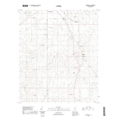
2020 Map of Old Spring Hill
USGS Topo · Published 2020About this map
The settlement of Old Spring Hill and the southeastern edge of Demopolis anchor this Marengo County landscape, defined by a network of creeks and small family cemeteries. Higher ground along Co Hwy 1 and Marengo Co 35 hosts several long-standing community landmarks, including the Old Spring Hill Methodist Cem and the Gilfield Community Cem. The landscape is etched by a intricate drainage system where French Cr and Rocky Br flow through the eastern hills, while the Whitfield Canal Extension and Falling Cr dominate the northern terrain near the municipal limits. This 2020 survey captures the transition from the institutional footprint of the Shelton State Community College Demopolis Campus to the surrounding rural reaches. For local historians, the numerous burial sites like the Fitzhugh Family Cem and Allen-Curtis Cem offer significant genealogical value, marking family landholdings across the townships.
Find a feature on this map
62 named features on this map. Tap any name to fly to it.
Don’t see what you’re looking for? This feature index may not catch every label — zoom into the map to look around manually.
Map Details
Editions of this 2020 Old Spring Hill Map
This is the sole edition of this map. No revisions or reprints were ever made.
Other maps of this area

1946 · Demopolis
USGS Topo · 1:24,000

1947 · Demopolis
USGS Topo · 1:24,000

1948 · Mc Dowell
USGS Topo · 1:24,000

1949 · Mc Dowell
USGS Topo · 1:24,000

1953 · Montgomery
USGS Topo · 1:250,000

1956 · Montgomery
USGS Topo · 1:250,000

1957 · Montgomery
USGS Topo · 1:250,000

1968 · Thomaston West
USGS Topo · 1:24,000

1968 · Gallion
USGS Topo · 1:24,000

1970 · Myrtlewood North
USGS Topo · 1:24,000