1974 Map of Olds Ferry SE
USGS Topo · Published 1975About this map
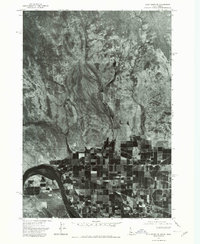
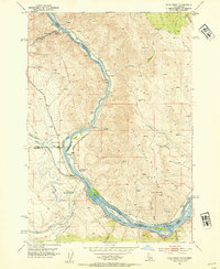
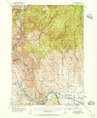
The Snake River carves through the lower portion of this mid-1970s orthophotograph, marking a sharp contrast between the irrigated agricultural grid and the high desert terrain to the north. This visual record, based on aerial photography from July 1974, reveals the precise geometry of crop circles and rectangular fields that define the river valley's development. North of the river, the landscape ascends toward the distinct peak of Kelly Mountain, characterized by complex drainage patterns from Warm Springs Creek and Scott Creek. The imagery allows for a detailed study of land use along the border of Idaho and Oregon, showing the extent of cultivated land reaching toward the more arid, dissected uplands near Jonathan.
Find a feature on this map
5 named features on this map. Tap any name to fly to it.
Don’t see what you’re looking for? This feature index may not catch every label — zoom into the map to look around manually.
Map Details
Editions of this 1974 Olds Ferry SE Map
This is the sole edition of this map. No revisions or reprints were ever made.
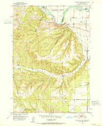
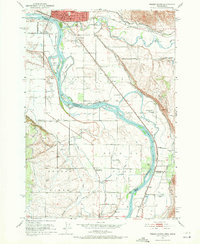
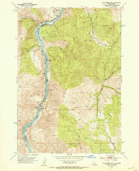
Other maps of this area

1897 · Weiser
USGS Topo · 1:125,000
1951 · Moores Hollow
USGS Topo · 1:24,000

1951 · Moores Hollow
USGS Topo · 1:62,500
1951 · Weiser South
USGS Topo · 1:24,000
1952 · Olds Ferry NW
USGS Topo · 1:24,000
1952 · Olds Ferry
USGS Topo · 1:24,000
1952 · Olds Ferry
USGS Topo · 1:62,500

1952 · Olds Ferry SE
USGS Topo · 1:24,000

1953 · Mann Creek
USGS Topo · 1:62,500

1955 · Baker
USGS Topo · 1:250,000