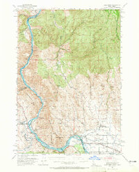
1952 Map of Olds Ferry
USGS Topo · Published 1965About this map
Snake River navigation and the legacy of westward migration define this high-desert borderland between Idaho and Oregon. The map documents a critical historic crossing at Olds Ferry, where the Union Pacific railroad and the Short Line track alongside the water. The corridor is rich with pioneer history, evidenced by the Oregon Trail winding through the hills and the specific placement of the Oregon Trail Mon. The settlement pattern of the early 1950s shows a landscape in transition, with several locations marked as former inhabitants or schools, such as Gypsum (Site) and the Eaton Sch (Aband). Irrigation infrastructure like the Galloway Canal supports the valley floor near Scott, while the uplands remain dominated by topographical landmarks like Indian Head Mtn and the Slaughterhouse Range.
Find a feature on this map
53 named features on this map. Tap any name to fly to it.
Don’t see what you’re looking for? This feature index may not catch every label — zoom into the map to look around manually.
Map Details
Editions of this 1952 Olds Ferry Map
3 editions found
Other maps of this area

1897 · Weiser
USGS Topo · 1:125,000

1915 · Pine
USGS Topo · 1:125,000

1950 · Jamieson
USGS Topo · 1:62,500

1951 · Moores Hollow
USGS Topo · 1:24,000

1951 · Moores Hollow
USGS Topo · 1:62,500

1951 · Huntington
USGS Topo · 1:62,500

1951 · Weiser South
USGS Topo · 1:24,000

1952 · Olds Ferry NW
USGS Topo · 1:24,000

1952 · Olds Ferry
USGS Topo · 1:24,000

1952 · Olds Ferry
USGS Topo · 1:62,500