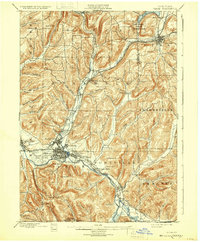
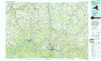
1898 Map of Olean
USGS Topo · Published 1921About this map
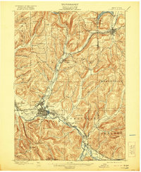
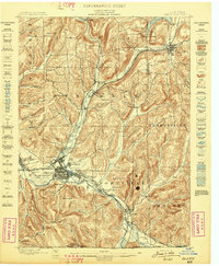
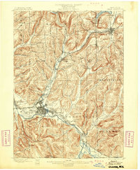
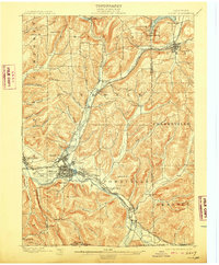
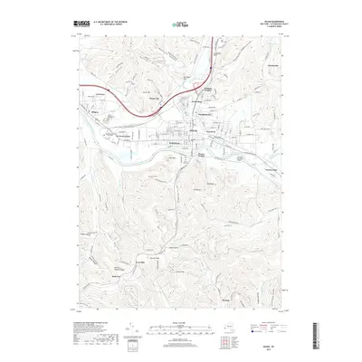
The Allegheny River valley serves as the industrial and transit corridor for this late 19th-century landscape, dominated by the emerging hub of Olean. The map captures the city's complex rail network at the junction of the Erie R. R. and the Western New York and Penna. R. R., while the presence of Oil Tanks south of the river reflects the region's significant role in the early petroleum industry. Surrounding the valley, the terrain is marked by steep ridges and narrow hollows like Fay Hollow and Woodchuck Hollow, directing settlement toward the creek bottoms. To the north, the Oil Spring Indian Reservation sits near the Reservoir and the town of Cuba. This survey documents a transitional economy where timber and tanning were giving way to heavier rail-based commerce, visible in the density of specialized trackage like the Narrow Gauge Div. near the southern border.
Find a feature on this map
74 named features on this map. Tap any name to fly to it.
Don’t see what you’re looking for? This feature index may not catch every label — zoom into the map to look around manually.
Map Details
Editions of this 1898 Olean Map
5 editions found
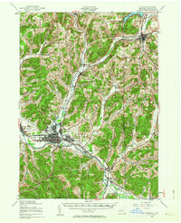
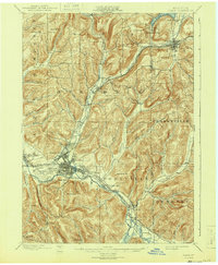
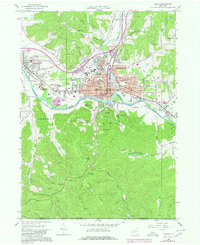
Historical Maps of Olean Through Time
10 maps found
1898 Olean
Cattaraugus County, NY
1938 Olean
Cattaraugus County, NY
1943 Olean
Cattaraugus County, NY
1961 Olean
Cattaraugus County, NY
1986 Olean
Cattaraugus County, NY
2010 Olean
Cattaraugus County, NY
2013 Olean
Cattaraugus County, NY
2016 Olean
Cattaraugus County, NY
2019 Olean
Cattaraugus County, NY

2023 Olean
Cattaraugus County, NY