2021 Map of Olean
USGS Topo · Published 2021About this map
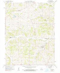
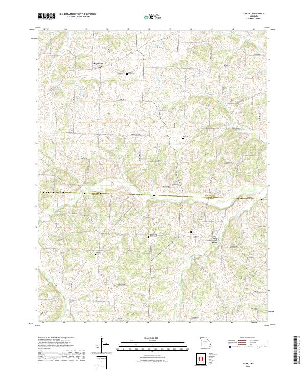
The settlement of Olean serves as a focal point in this portion of the Missouri landscape, situated near the border between Moniteau Co and Miller Co. The terrain is defined by the drainage networks of S Moreau Cr and its tributaries, including Blythes Cr and Rock Enon Cr. This rural area is marked by a high density of family and community burial grounds, such as Walker Cem, Allen Cem, and the Green Ridge Baptist Church Cem, which provide significant points of interest for genealogical research. Further north, the community of High Point sits along State Hwy C, surrounded by a network of local roads like Coal Banks Rd and Fish Farm Rd. The map illustrates a well-developed rural infrastructure of highways and secondary roads connecting these small towns and agricultural lands across the county line.
Find a feature on this map
81 named features on this map. Tap any name to fly to it.
Don’t see what you’re looking for? This feature index may not catch every label — zoom into the map to look around manually.
Map Details
Editions of this 2021 Olean Map
This is the sole edition of this map. No revisions or reprints were ever made.