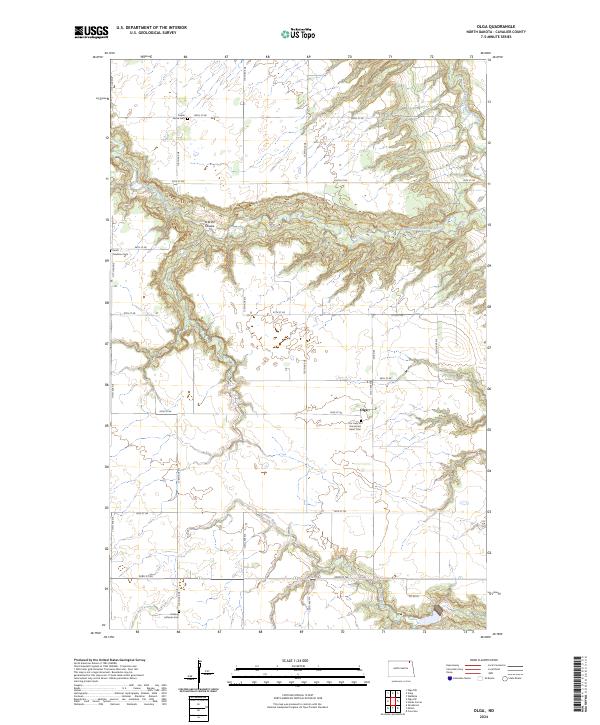
2024 Map of Olga
USGS Topo · Published 2024About this map
The Olga settlement sits at the center of this rural landscape in Cavalier County, where the plains of North Dakota are deeply etched by the winding course of the Little South Pembina River. The terrain is defined by the sharp descent from the plateau into the river valley, most notably at O'Brien Coulee, creating a localized topography of drainage patterns that stands in contrast to the surrounding agricultural grid. The area’s history is reflected in several distinct burial grounds scattered across the townships, including Poplar Grove Cem and South Pembina Cem, which likely served early farming families. Further south, the Tongue River meanders toward the corner of the map, while Our Lady of the Sacred Heart Cem and Golberg Lutheran Cem mark the enduring presence of local congregations within this quiet prairie environment.
Find a feature on this map
28 named features on this map. Tap any name to fly to it.
Don’t see what you’re looking for? This feature index may not catch every label — zoom into the map to look around manually.
Map Details
Editions of this 2024 Olga Map
This is the sole edition of this map. No revisions or reprints were ever made.
Other maps of this area

1918 · Walhalla
USGS Topo · 1:62,500

1943 · Walhalla
USGS Topo · 1:62,500

1952 · Thief River Falls
USGS Topo · 1:250,000

1953 · Devils Lake
USGS Topo · 1:250,000

1956 · Thief River Falls
USGS Topo · 1:250,000

1956 · Devils Lake
USGS Topo · 1:250,000

1957 · Thief River Falls
USGS Topo · 1:250,000

1964 · Walhalla
USGS Topo · 1:24,000
1964 · Concrete
USGS Topo · 1:24,000
1964 · Hanks Corner
USGS Topo · 1:24,000