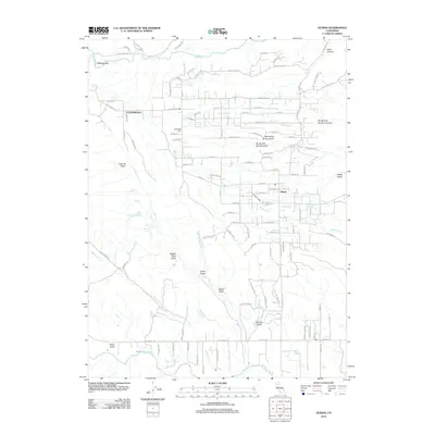
2012 Map of Olinda
USGS Topo · Published 2012About this map
Cloverdale and Olinda anchor this portion of Shasta County, illustrating a landscape where rural residential expansion meets a network of deep gulches and creek beds. The area is defined by its drainage systems, including the prominent Clear Creek and Cottonwood Creek, which have historically shaped local movement and settlement. Local history is physically marked at the Cloverdale Cemetery, while terrain names like Coal Pit Gulch and Wagon Road Gulch hint at the area's early industrial and transport heritage. Near the settlement of Happy Valley, the presence of Olinda Reservoir and the winding Olinda Creek emphasize the importance of water management in this Mediterranean climate. The map captures a transition toward modern rural development, with numerous named residential roads such as China Gulch Drive and Happy Valley Road weaving between established landforms like Niles Canyon.
Find a feature on this map
102 named features on this map. Tap any name to fly to it.
Don’t see what you’re looking for? This feature index may not catch every label — zoom into the map to look around manually.
Map Details
Editions of this 2012 Olinda Map
This is the sole edition of this map. No revisions or reprints were ever made.
Other maps of this area

1890 · Red Bluff
USGS Topo · 1:250,000

1894 · Red Bluff
USGS Topo · 1:250,000

1901 · Redding
USGS Topo · 1:125,000

1913 · Weaverville
USGS Topo · 1:125,000

1932 · Olinda
USGS Topo · 1:31,680

1935 · Olinda
USGS Topo · 1:31,680

1944 · Redding
USGS Topo · 1:62,500

1944 · French Gulch
USGS Topo · 1:62,500

1946 · Redding
USGS Topo · 1:62,500

1947 · Anderson
USGS Topo · 1:62,500