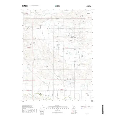
2018 Map of Olinda
USGS Topo · Published 2018About this map
The northern edge of the Sacramento Valley meets the foothills of the Klamath Mountains in this detailed 2018 survey. The landscape is defined by a dense network of watercourses and canyons, including Spanish Canyon and Niles Canyon, which drain into the prominent Clear Creek. The settlement patterns here reflect a mix of rural residential development and agricultural roots, with the communities of Cloverdale, Olinda, and Happy Valley serving as local hubs. Local history and genealogy are anchored by features such as the Cloverdale Cem and the historical site of Readings Bar. The terrain is deeply incised by uniquely named drainages like Coal Pit Gulch, Wagon Road Gulch, and Telephone Gulch, suggesting a legacy of early industry and transport routes. Significant water management is evident at the Olinda Reservoir, while the southern reaches of the map extend toward the Cottonwood Creek drainage near the boundary between Shasta and Tehama counties.
Find a feature on this map
129 named features on this map. Tap any name to fly to it.
Don’t see what you’re looking for? This feature index may not catch every label — zoom into the map to look around manually.
Map Details
Editions of this 2018 Olinda Map
This is the sole edition of this map. No revisions or reprints were ever made.
Other maps of this area

1890 · Red Bluff
USGS Topo · 1:250,000

1894 · Red Bluff
USGS Topo · 1:250,000

1901 · Redding
USGS Topo · 1:125,000

1913 · Weaverville
USGS Topo · 1:125,000

1932 · Olinda
USGS Topo · 1:31,680

1935 · Olinda
USGS Topo · 1:31,680

1944 · Redding
USGS Topo · 1:62,500

1944 · French Gulch
USGS Topo · 1:62,500

1946 · Redding
USGS Topo · 1:62,500

1947 · Anderson
USGS Topo · 1:62,500