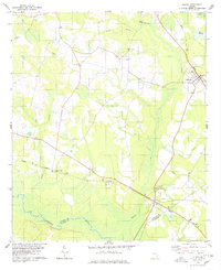
1978 Map of Oliver
USGS Topo · Published 1978About this map
The Central of Georgia railroad corridor anchors this late-1970s survey of Screven County, following a northwest-southeast path through a landscape defined by its wetlands and river branches. The small town of Oliver sits at the junction of this rail line and the Ogeechee River, marking a critical point where the borders of Screven, Bulloch, and Effingham counties meet. The interior is characterized by numerous water bodies like Cyphus Pond and the depressions of Mobley Bay, punctuated by established community anchors such as St Johns Ch, Faith Temple, and Williams Chapel. This period shows a rural environment transition as a modern pipeline cuts across the traditional topography, bypassing older settlements like Stalco, Halcyondale, and the community of Newington in the northeast. The map provides clear evidence of the local extraction economy through several identified Gravel Pits located near the railway and river basin.
Find a feature on this map
21 named features on this map. Tap any name to fly to it.
Don’t see what you’re looking for? This feature index may not catch every label — zoom into the map to look around manually.
Map Details
Editions of this 1978 Oliver Map
This is the sole edition of this map. No revisions or reprints were ever made.
Other maps of this area

1918 · Oliver
USGS Topo · 1:62,500

1919 · Shirley
USGS Topo · 1:62,500

1919 · Egypt
USGS Topo · 1:62,500

1920 · Oliver
USGS Topo · 1:62,500

1921 · Brooklet
USGS Topo · 1:62,500

1939 · Egypt
USGS Topo · 1:62,500

1943 · Brooklet
USGS Topo · 1:62,500

1943 · Egypt
USGS Topo · 1:62,500

1943 · Shirley
USGS Topo · 1:62,500

1943 · Millen
USGS Topo · 1:125,000