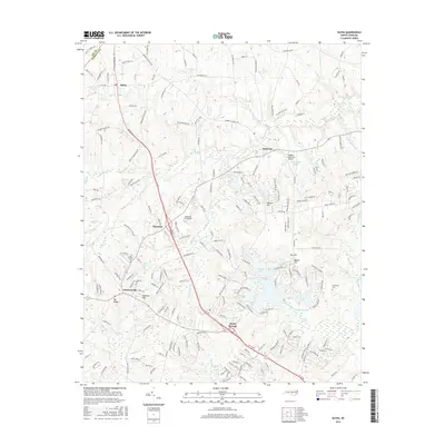
2016 Map of Olivia
USGS Topo · Published 2016About this map
The boundary between Lee Co and Harnett Co bisects a landscape defined by low ridges and an intricate network of wetlands in this 2016 survey. Small settlements such as Olivia, Barbecue, and Pineview are connected by a rural road system, while larger developments like Linden Oaks and Spout Springs mark the southern reach of the map. The terrain is notably punctuated by several named elevations, including Cameron Hill and Big Ridge, which rise above the expansive Gum Swamp and Reedys Swamp.
Find a feature on this map
214 named features on this map. Tap any name to fly to it.
Don’t see what you’re looking for? This feature index may not catch every label — zoom into the map to look around manually.
Map Details
Editions of this 2016 Olivia Map
This is the sole edition of this map. No revisions or reprints were ever made.
Other maps of this area

1948 · Fayetteville
USGS Topo · 1:62,500

1948 · Clifdale
USGS Topo · 1:62,500

1950 · Lobelia
USGS Topo · 1:24,000

1950 · Manchester
USGS Topo · 1:24,000

1951 · Clifdale
USGS Topo · 1:62,500

1953 · Raleigh
USGS Topo · 1:250,000

1954 · Raleigh
USGS Topo · 1:250,000

1956 · Anderson Creek
USGS Topo · 1:24,000

1957 · Murchisontown
USGS Topo · 1:24,000
1957 · Lobelia
USGS Topo · 1:24,000