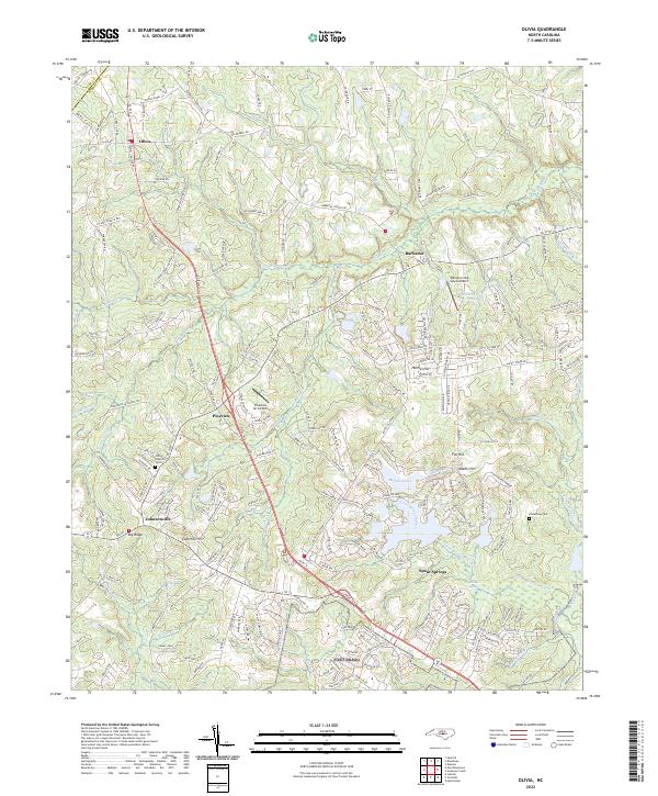
2022 Map of Olivia
USGS Topo · Published 2022About this map
Johnsonville and Olivia anchor this landscape along the Lee and Harnett County line, where the terrain transitions from agricultural fields to the densely wooded corridors of Gum Swamp and Barbecue Creek. The area is marked by a legacy of local institutions, evidenced by Old Church Cem and historical road names like Benhaven School Rd and Johnsonville School Rd. In the southern portion of the sheet, the community of Spout Springs sits near the headwaters of Little Bridge Branch, while the expansive Buffalo Lakes provide a significant hydrographic feature in the central district. Aviation is represented by both the William Irving Lewis Airport and Pineview Air Airport, highlighting the region's connection to regional travel. The map also details numerous family-named landmarks and hills, such as Cameron Hill and Mathis Hill, which provide topographic relief in this part of the North Carolina sandhills.
Find a feature on this map
239 named features on this map. Tap any name to fly to it.
Don’t see what you’re looking for? This feature index may not catch every label — zoom into the map to look around manually.
Map Details
Editions of this 2022 Olivia Map
This is the sole edition of this map. No revisions or reprints were ever made.
Other maps of this area

1948 · Fayetteville
USGS Topo · 1:62,500

1948 · Clifdale
USGS Topo · 1:62,500

1950 · Lobelia
USGS Topo · 1:24,000

1950 · Manchester
USGS Topo · 1:24,000

1951 · Clifdale
USGS Topo · 1:62,500

1953 · Raleigh
USGS Topo · 1:250,000

1954 · Raleigh
USGS Topo · 1:250,000

1956 · Anderson Creek
USGS Topo · 1:24,000

1957 · Murchisontown
USGS Topo · 1:24,000
1957 · Lobelia
USGS Topo · 1:24,000