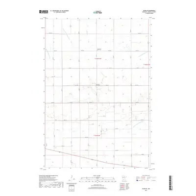
2019 Map of Olivia SE
USGS Topo · Published 2019About this map
Agricultural patterns and complex water management systems define this portion of Renville County. The landscape is structured by an extensive network of drainage features, including the winding course of Buffalo Cr and engineered channels such as County Ditch Number Sixtyseven and Judicial Ditch Number Nine. These waterworks reflect the region's long-standing commitment to reclaiming and maintaining productive farmland from the prairie wetlands. Community heritage is preserved at several local landmarks, notably Saint John's Lutheran Cem along 850th Ave and the United Church of Hope Cem to the north. The map also details the grid-like progression of rural routes from Co Hwy 11 to Co Rd 70, showing the enduring layout of township sections and local land use.
Find a feature on this map
25 named features on this map. Tap any name to fly to it.
Don’t see what you’re looking for? This feature index may not catch every label — zoom into the map to look around manually.
Map Details
Editions of this 2019 Olivia SE Map
This is the sole edition of this map. No revisions or reprints were ever made.
Other maps of this area

1952 · Morton
USGS Topo · 1:62,500

1953 · New Ulm
USGS Topo · 1:250,000

1957 · New Ulm
USGS Topo · 1:250,000

1957 · Olivia
USGS Topo · 1:62,500

1958 · New Ulm
USGS Topo · 1:250,000

1964 · Hector
USGS Topo · 1:24,000

1967 · New Ulm
USGS Topo · 1:250,000

1967 · Churchill
USGS Topo · 1:24,000
1967 · Cosmos
USGS Topo · 1:24,000
1982 · Olivia SE
USGS Topo · 1:24,000