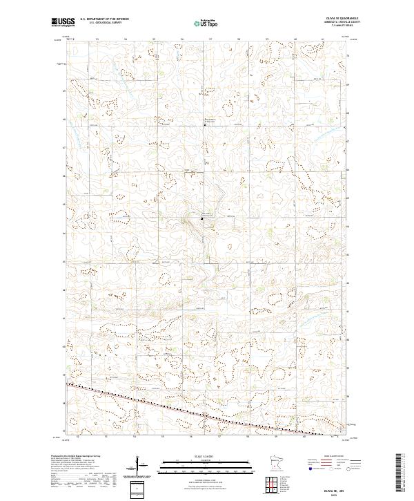
2022 Map of Olivia SE
USGS Topo · Published 2022About this map
The agricultural landscape of Renville County is defined by an intricate network of drainage systems, including County Ditch Number Sixtyseven and Judicial Ditch Number Nine. These engineered waterways, alongside Buffalo Cr, reflect the transition of this prairie region into highly productive farmland. The grid-based road system, with routes like Co Hwy 11 and 840th Ave, organizes the territory into neat sections typical of the Midwestern plains.
Find a feature on this map
27 named features on this map. Tap any name to fly to it.
Don’t see what you’re looking for? This feature index may not catch every label — zoom into the map to look around manually.
Map Details
Editions of this 2022 Olivia SE Map
This is the sole edition of this map. No revisions or reprints were ever made.
Other maps of this area

1952 · Morton
USGS Topo · 1:62,500

1953 · New Ulm
USGS Topo · 1:250,000

1957 · New Ulm
USGS Topo · 1:250,000

1957 · Olivia
USGS Topo · 1:62,500

1958 · New Ulm
USGS Topo · 1:250,000

1964 · Hector
USGS Topo · 1:24,000

1967 · New Ulm
USGS Topo · 1:250,000

1967 · Churchill
USGS Topo · 1:24,000
1967 · Cosmos
USGS Topo · 1:24,000
1982 · Olivia SE
USGS Topo · 1:24,000