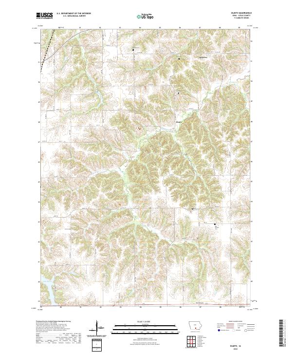
2022 Map of Olmitz
USGS Topo · Published 2022About this map
The small settlements of Olmitz and Tipperary anchor this rural Lucas County landscape, which is defined by a dense network of timbered creek bottoms and narrow ridges. The drainage of English Creek and the north fork of N Cedar Cr carve through the terrain, creating the deep recesses of Possum Hollow in the central portion of the quadrangle. This area preserves a significant amount of genealogical data through several well-placed burial grounds, including Belinda Cem, Bethel Cem, and the descriptive Old Ireland Cem located near the eastern edge. To the south, the waters of Lake Morris and the private landing strip at Beck Airport represent more modern additions to the traditional agrarian land use patterns. The map is intersected by a grid of county roads and avenues such as 290th Ave and 550th St, providing clear access to the scattered farms and historic family sites throughout the region.
Find a feature on this map
55 named features on this map. Tap any name to fly to it.
Don’t see what you’re looking for? This feature index may not catch every label — zoom into the map to look around manually.
Map Details
Editions of this 2022 Olmitz Map
This is the sole edition of this map. No revisions or reprints were ever made.
Other maps of this area

1918 · Chariton
USGS Topo · 1:62,500

1924 · Melcher
USGS Topo · 1:62,500

1934 · Humeston
USGS Topo · 1:48,000

1935 · Russell
USGS Topo · 1:62,500

1937 · Corydon
USGS Topo · 1:62,500

1938 · Russell
USGS Topo · 1:62,500

1954 · Centerville
USGS Topo · 1:250,000

1954 · Des Moines
USGS Topo · 1:250,000

1956 · Des Moines
USGS Topo · 1:250,000

1957 · Des Moines
USGS Topo · 1:250,000