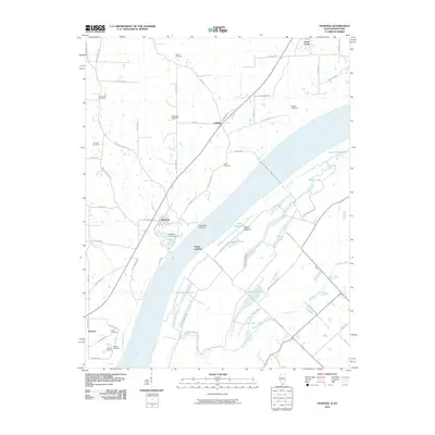
2010 Map of Olmsted
USGS Topo · Published 2010About this map
The Ohio River frontage defines this southern Illinois landscape, where river commerce and rural settlements have long converged at the Kentucky border. Near Olmsted, the terrain transitions from the upland bluffs marked by numerous family and community burial grounds, such as Bethlehem Cemetery and Mount Zion Cemetery, to the expansive lowlands of Oscar Bottoms. Historical river access points like Caledonia Landing and Turner Landing speak to the area's legacy of waterway navigation, while inland, the small community of Levings sits at a crossroads of county routes. The map detail highlights a complex network of backwater lakes and sloughs including Little Turner Lake, Beaverdam Lake, and Burnt Slough Lake, which reflect the dynamic hydrological character of the river valley. Further south, the map captures the transition toward the settlement of America, preserving the names of local landmarks like Lyerly Cemetery and Sheets Cemetery for genealogical research.
Find a feature on this map
72 named features on this map. Tap any name to fly to it.
Don’t see what you’re looking for? This feature index may not catch every label — zoom into the map to look around manually.
Map Details
Editions of this 2010 Olmsted Map
This is the sole edition of this map. No revisions or reprints were ever made.
Other maps of this area

1918 · Vienna
USGS Topo · 1:62,500

1919 · Vienna
USGS Topo · 1:62,500

1920 · Dongola
USGS Topo · 1:62,500

1923 · Dongola
USGS Topo · 1:62,500

1928 · La Center
USGS Topo · 1:62,500

1931 · Cairo
USGS Topo · 1:62,500

1932 · La Center
USGS Topo · 1:62,500

1933 · Cairo
USGS Topo · 1:62,500

1939 · Cairo
USGS Topo · 1:62,500

1942 · Vienna
USGS Topo · 1:62,500