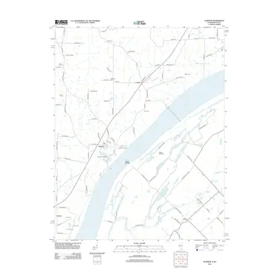
2012 Map of Olmsted
USGS Topo · Published 2012About this map
The Ohio River serves as the dominant geographical force on this map, carving a wide path between Illinois and Kentucky near the settlements of Olmsted and America. The shoreline is punctuated by historic access points like Caledonia Landing and Turner Landing, while the interior landscape is defined by the extensive wetlands of Oscar Bottoms. This low-lying drainage system includes numerous named water bodies such as Turkey Lake, Goose Pond, and Little Turner Lake, which signify the complex hydrology of the river's floodplain.
Find a feature on this map
101 named features on this map. Tap any name to fly to it.
Don’t see what you’re looking for? This feature index may not catch every label — zoom into the map to look around manually.
Map Details
Editions of this 2012 Olmsted Map
This is the sole edition of this map. No revisions or reprints were ever made.
Other maps of this area

1918 · Vienna
USGS Topo · 1:62,500

1919 · Vienna
USGS Topo · 1:62,500

1920 · Dongola
USGS Topo · 1:62,500

1923 · Dongola
USGS Topo · 1:62,500

1928 · La Center
USGS Topo · 1:62,500

1931 · Cairo
USGS Topo · 1:62,500

1932 · La Center
USGS Topo · 1:62,500

1933 · Cairo
USGS Topo · 1:62,500

1939 · Cairo
USGS Topo · 1:62,500

1942 · Vienna
USGS Topo · 1:62,500