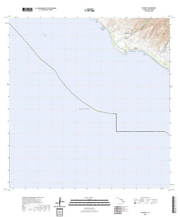
2024 Map of Olowalu
USGS Topo · Published 2024About this map
The coastal village of Olowalu and its surrounding agricultural infrastructure dominate this West Maui landscape. Inland from the Pacific Ocean, the terrain rises sharply toward the peak of Ko'ai, deeply etched by the Ukumehame Gulch. Water management is a defining characteristic of the local geography, evidenced by the Olowalu Ditch and the Ukumehame Reservoirs which serve the lower settlements. Along the shoreline, distinct coastal features like Hekili Point and Awalua Kulanaokalai Beach define the narrow strip of habitable land between the mountains and the 'Au'au Channel. This modern survey illustrates the persistent footprint of older settlements such as Kilea and Mōpua amidst the island's drainage patterns and modern road network like Luawai St.
Find a feature on this map
18 named features on this map. Tap any name to fly to it.
Don’t see what you’re looking for? This feature index may not catch every label — zoom into the map to look around manually.
Map Details
Editions of this 2024 Olowalu Map
This is the sole edition of this map. No revisions or reprints were ever made.
Other maps of this area

1929 · Kahoolawe
USGS Topo · 1:62,500

1954 · Maui
USGS Topo · 1:250,000

1954 · Maalaea
USGS Topo · 1:24,000

1955 · Olowalu
USGS Topo · 1:24,000

1955 · Wailuku
USGS Topo · 1:24,000

1956 · Lahaina
USGS Topo · 1:24,000

1966 · Maui
USGS Topo · 1:250,000

1974 · Maui
USGS Topo · 1:250,000

1977 · Wailuku
USGS Topo · 1:24,000
1978 · Lahaina
USGS Topo · 1:24,000