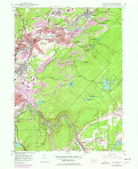
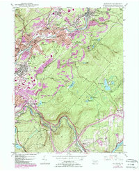
1946 Map of Olyphant
USGS Topo · Published 1978About this map
The Lackawanna River corridor serves as the industrial and social spine of this Lackawanna County valley, where the rails of the Delaware and Hudson and Conrail lines connect a dense string of coal-country settlements. From the boroughs of Olyphant and Blakely to the heights of Prospect Hill, the landscape is defined by its anthracite heritage, evidenced by numerous Strip Mines that dot the surrounding ridges.
Find a feature on this map
87 named features on this map. Tap any name to fly to it.
Don’t see what you’re looking for? This feature index may not catch every label — zoom into the map to look around manually.
Map Details
Editions of this 1946 Olyphant Map
6 editions found

Other maps of this area

1889 · Scranton
USGS Topo · 1:62,500

1891 · Scranton
USGS Topo · 1:62,500

1892 · Honesdale
USGS Topo · 1:62,500

1892 · Dundaff
USGS Topo · 1:62,500

1893 · Scranton
USGS Topo · 1:62,500

1928 · Ariel
USGS Topo · 1:62,500

1932 · Ariel
USGS Topo · 1:62,500

1943 · Scranton
USGS Topo · 1:125,000

1943 · Honesdale
USGS Topo · 1:125,000

1946 · Dalton
USGS Topo · 1:24,000