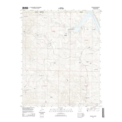
2014 Map of Omaha NE
USGS Topo · Published 2014About this map
Bull Shoals Lake defines the northern and eastern reaches of this Ozark plateau landscape on the border of Missouri and Arkansas. The terrain is deeply incised by countless hollows, including McGill Hollow and Carrollton Hollow, which drain toward the reservoir. Small community centers and named crossroads such as Boone, Lead Hill, and Self are connected by a network of state routes like Ar-14 and Ar-281. The map reveals the modern settlement patterns of the 2010s, where older established places like Stonington and Bellville sit alongside newer residential developments such as the Crumpler Subdivision. Genealogists may find value in the location of the Cottonwood Cem near the Barren Fork, providing a specific point of reference for families settled in this part of Boone County.
Find a feature on this map
75 named features on this map. Tap any name to fly to it.
Don’t see what you’re looking for? This feature index may not catch every label — zoom into the map to look around manually.
Map Details
Editions of this 2014 Omaha NE Map
This is the sole edition of this map. No revisions or reprints were ever made.
Other maps of this area

1893 · Yellville
USGS Topo · 1:125,000

1903 · Yellville
USGS Topo · 1:125,000

1904 · Harrison
USGS Topo · 1:125,000

1905 · Harrison
USGS Topo · 1:125,000

1905 · Yellville
USGS Topo · 1:125,000

1907 · Forsyth
USGS Topo · 1:125,000

1929 · Yellville
USGS Topo · 1:125,000

1943 · Protem
USGS Topo · 1:62,500

1945 · Harrison
USGS Topo · 1:250,000

1949 · Harrison
USGS Topo · 1:250,000