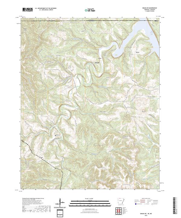
2024 Map of Omaha NE
USGS Topo · Published 2024About this map
Lowry and Bellville sit at the northern edge of this Arkansas landscape, where the terrain breaks sharply toward the waters of Bull Shoals Lake. The topography is defined by deeply cut drainages such as Clinton Hollow and Bear Creek, illustrating the dissection of the Ozark plateau before it reaches the impounded White River system. Evidence of early rural life is found at the Cottonwood Cem near Self and the Chaney Cem further north, markers of small communities that once clustered near the Missouri-Arkansas line. The presence of Lead Hill and drainage names like Lead Mine Creek suggest the mineral history of the region. This 2024 edition provides a contemporary view of these traditional settlements, including White Oak Mtn, showing how modern routes like State Hwy 281 N follow the winding ridgelines established by generations of travel.
Find a feature on this map
76 named features on this map. Tap any name to fly to it.
Don’t see what you’re looking for? This feature index may not catch every label — zoom into the map to look around manually.
Map Details
Editions of this 2024 Omaha NE Map
This is the sole edition of this map. No revisions or reprints were ever made.
Other maps of this area

1893 · Yellville
USGS Topo · 1:125,000

1903 · Yellville
USGS Topo · 1:125,000

1904 · Harrison
USGS Topo · 1:125,000

1905 · Harrison
USGS Topo · 1:125,000

1905 · Yellville
USGS Topo · 1:125,000

1907 · Forsyth
USGS Topo · 1:125,000

1929 · Yellville
USGS Topo · 1:125,000

1943 · Protem
USGS Topo · 1:62,500

1945 · Harrison
USGS Topo · 1:250,000

1949 · Harrison
USGS Topo · 1:250,000