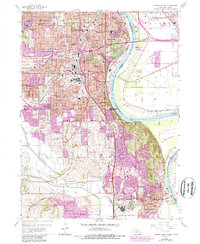
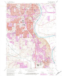
1956 Map of Omaha South
USGS Topo · Published 1989About this map
The Missouri River forms a wide, meandering boundary between Nebraska and Iowa, anchoring a landscape shaped by mid-century urban expansion and military infrastructure. In the south, the sprawling Offutt Air Force Base stands as a primary landmark near Bellevue and Ft Crook. The map reveals a dense network of local schools and parish centers, such as St Rose Sch and Holy Ghost Sch, which served the growing neighborhoods of South Omaha and Avery.
Find a feature on this map
83 named features on this map. Tap any name to fly to it.
Don’t see what you’re looking for? This feature index may not catch every label — zoom into the map to look around manually.
Map Details
Editions of this 1956 Omaha South Map
6 editions found

Other maps of this area

1893 · Omaha
USGS Topo · 1:62,500

1893 · Fremont
USGS Topo · 1:125,000

1896 · Fremont
USGS Topo · 1:125,000

1954 · Omaha
USGS Topo · 1:250,000

1955 · Fremont
USGS Topo · 1:250,000

1956 · Cedar Creek
USGS Topo · 1:24,000

1956 · Ralston
USGS Topo · 1:24,000

1956 · Irvington
USGS Topo · 1:24,000

1956 · Plattsmouth
USGS Topo · 1:24,000

1956 · Council Bluffs North
USGS Topo · 1:24,000