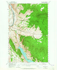
1953 Map of Omak Lake
USGS Topo · Published 1965About this map
The Colville Indian Reservation landscape is defined by the sharp transition from the fertile valley of the Okanogan River to the high timbered slopes of Omak Mtn and Van Brunt Mtn. Along the river’s eastern bank, the Great Northern railroad tracks parallel the water, passing the settlement of Cherokee and serving the fruit-growing region north of Riverside. This 1953 field-checked survey reveals the spiritual and social center of the area at St Marys Mission, situated near Mission Creek where the terrain begins its ascent toward the reservation interior.
Find a feature on this map
56 named features on this map. Tap any name to fly to it.
Don’t see what you’re looking for? This feature index may not catch every label — zoom into the map to look around manually.
Map Details
Editions of this 1953 Omak Lake Map
2 editions found
Other maps of this area

1902 · Osoyoos
USGS Topo · 1:125,000

1904 · Osoyoos
USGS Topo · 1:125,000

1905 · Okanogan
USGS Topo · 1:125,000

1906 · Chopaka
USGS Topo · 1:125,000

1950 · Boot Mtn
USGS Topo · 1:62,500

1950 · Alameda Flat
USGS Topo · 1:62,500

1952 · Alameda Flat
USGS Topo · 1:62,500

1952 · Disautel
USGS Topo · 1:62,500

1953 · Omak Lake
USGS Topo · 1:62,500

1954 · Okanogan
USGS Topo · 1:250,000