
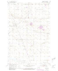
1954 Map of Omemee
USGS Topo · Published 1956About this map
The Great Northern and Minneapolis St Paul and Sault Ste Marie railroads intersect in the heart of the North Dakota prairie, defining the development of this rural Bottineau County landscape in the mid-1950s. The settlement of Omemee sits at this significant junction, surrounded by the expansive reaches of Amity, Lordsburg, and Willow Vale. To the south and east, smaller railway stops and local landmarks emerge, including Belmar near Belmar Slough and the isolated Tasco siding. These small clusters, along with the Tasco Cem, provide essential anchor points for genealogists tracing family roots in the former townships. The terrain is characterized by a high concentration of prairie potholes and sloughs, with Miller Creek and Willow Creek winding through the southern sections near Ostby and Wellington, illustrating the natural drainage patterns that influenced agricultural settlement.
Find a feature on this map
20 named features on this map. Tap any name to fly to it.
Don’t see what you’re looking for? This feature index may not catch every label — zoom into the map to look around manually.
Map Details
Editions of this 1954 Omemee Map
2 editions found
Other maps of this area

1935 · Dunseith
USGS Topo · 1:48,000

1939 · Dunseith
USGS Topo · 1:62,500

1950 · Willow City SW
USGS Topo · 1:24,000

1954 · Barton
USGS Topo · 1:24,000

1954 · Gardena
USGS Topo · 1:24,000

1954 · Willow City
USGS Topo · 1:24,000

1954 · Minot
USGS Topo · 1:250,000

1955 · Lords Lake
USGS Topo · 1:24,000

1955 · Overly
USGS Topo · 1:24,000

1955 · Bottineau
USGS Topo · 1:24,000