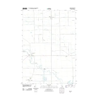
2011 Map of Omer
USGS Topo · Published 2011About this map
The Rifle River winds south through the heart of Arenac County, defining the recreational and residential landscape of this region. This 2011 survey illustrates the spatial relationship between the small incorporated city of Omer and the village of Twining, both established as centers of commerce along the local road network. The river's influence is clear, supporting multiple leisure sites such as Big Bend Family Campground and Russell's Canoes and Campgrounds, while crossing points like Huckle Bridge provide essential local connections.
Find a feature on this map
56 named features on this map. Tap any name to fly to it.
Don’t see what you’re looking for? This feature index may not catch every label — zoom into the map to look around manually.
Map Details
Editions of this 2011 Omer Map
This is the sole edition of this map. No revisions or reprints were ever made.
Other maps of this area

1954 · Flint
USGS Topo · 1:250,000

1954 · Tawas City
USGS Topo · 1:250,000

1958 · Flint
USGS Topo · 1:250,000

1958 · Tawas City
USGS Topo · 1:250,000

1966 · Au Gres
USGS Topo · 1:24,000

1966 · National City
USGS Topo · 1:24,000
1967 · Standish NE
USGS Topo · 1:24,000
1967 · Standish
USGS Topo · 1:24,000

1968 · Prescott
USGS Topo · 1:24,000

1968 · Whittemore
USGS Topo · 1:24,000