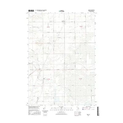
2017 Map of Omer
USGS Topo · Published 2017About this map
The Rifle River winds south through Arenac County, passing the settlement of Omer and continuing toward the wetland complex of Duck Lake Swamp. This modern survey illustrates a landscape deeply shaped by agricultural drainage and its riverine corridor, with a dense network of water management features including Bum Drain, Mosquito Drain, and Chief Cr Drain. Local landmarks such as Huckle Bridge and the Saint Edwards Catholic Cem provide specific points of interest for those tracing the development of this rural Michigan community.
Find a feature on this map
69 named features on this map. Tap any name to fly to it.
Don’t see what you’re looking for? This feature index may not catch every label — zoom into the map to look around manually.
Map Details
Editions of this 2017 Omer Map
This is the sole edition of this map. No revisions or reprints were ever made.
Other maps of this area

1954 · Flint
USGS Topo · 1:250,000

1954 · Tawas City
USGS Topo · 1:250,000

1958 · Flint
USGS Topo · 1:250,000

1958 · Tawas City
USGS Topo · 1:250,000

1966 · Au Gres
USGS Topo · 1:24,000

1966 · National City
USGS Topo · 1:24,000
1967 · Standish NE
USGS Topo · 1:24,000
1967 · Standish
USGS Topo · 1:24,000

1968 · Prescott
USGS Topo · 1:24,000

1968 · Whittemore
USGS Topo · 1:24,000