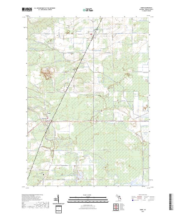
2023 Map of Omer
USGS Topo · Published 2023About this map
The Rifle River meanders through this Arenac County landscape, anchoring the settlement of Omer at its southern bend. To the north, the community of Twining sits at a junction of rail-aligned roads, surrounded by a complex network of agricultural drainage systems such as the Mosquito Drain, Bum Drain, and Cedar Creek Drain. The map reveals a land defined by its water management, where the extensive Duck Lake Swamp and the channelized Duck Lake Drain transition into the denser woodlands of the eastern townships. Cultural sites are concentrated near the settled areas, including the Saint Edwards Catholic Cem in Omer and the Arenac Township Cem further south. The drainage patterns of Big Creek and Chub Creek illustrate the historical effort to manage the local wetlands for farming, while named thoroughfares like Tyler Plains Rd and Hickory Island Rd hint at the distinct terrain features that once characterized this region.
Find a feature on this map
49 named features on this map. Tap any name to fly to it.
Don’t see what you’re looking for? This feature index may not catch every label — zoom into the map to look around manually.
Map Details
Editions of this 2023 Omer Map
This is the sole edition of this map. No revisions or reprints were ever made.
Other maps of this area

1954 · Flint
USGS Topo · 1:250,000

1954 · Tawas City
USGS Topo · 1:250,000

1958 · Flint
USGS Topo · 1:250,000

1958 · Tawas City
USGS Topo · 1:250,000

1966 · Au Gres
USGS Topo · 1:24,000

1966 · National City
USGS Topo · 1:24,000
1967 · Standish NE
USGS Topo · 1:24,000
1967 · Standish
USGS Topo · 1:24,000

1968 · Prescott
USGS Topo · 1:24,000

1968 · Whittemore
USGS Topo · 1:24,000