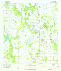
1956 Map of Ona
USGS Topo · Published 1957About this map
Ona serves as the central settlement in this mid-century view of Hardee County, where the Seaboard Air Line railroad cuts a straight north-south path through the low-lying Florida landscape. The terrain is defined by a intricate network of waterways, most notably Horse Creek, which feeds into the Horse Creek Prairie in the western portion of the quadrangle. This area was mapped using 1951 aerial photography, revealing a land used for cattle and timber where wide prairies and seasonal wetlands dominate.
Find a feature on this map
14 named features on this map. Tap any name to fly to it.
Don’t see what you’re looking for? This feature index may not catch every label — zoom into the map to look around manually.
Map Details
Editions of this 1956 Ona Map
3 editions found
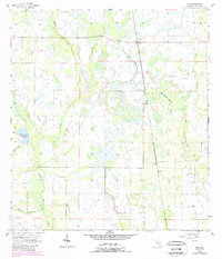
Other maps of this area

1955 · Ft. Green
USGS Topo · 1:24,000

1955 · Wauchula
USGS Topo · 1:24,000

1956 · Gardner
USGS Topo · 1:24,000

1956 · Ona
USGS Topo · 1:24,000

1956 · Edgeville
USGS Topo · 1:24,000

1956 · Myakka Head
USGS Topo · 1:24,000

1956 · Limestone
USGS Topo · 1:24,000

1956 · Zolfo Springs
USGS Topo · 1:24,000

1956 · Duette
USGS Topo · 1:24,000

1956 · Tampa
USGS Topo · 1:250,000