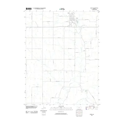
2010 Map of Onaga
USGS Topo · Published 2010About this map
Onaga serves as the primary hub in this portion of Pottawatomie County, situated where the Union Pacific RR cuts through the northern landscape. The town's grid is bounded to the south by the Onaga Byp, while the Onaga Airport sits just to the northwest. This area is defined by a dense network of drainage, where Vermillion Creek and its tributaries, including Mill Creek, Spring Creek, and Jim Creek, carve through the rural countryside.
Find a feature on this map
41 named features on this map. Tap any name to fly to it.
Don’t see what you’re looking for? This feature index may not catch every label — zoom into the map to look around manually.
Map Details
Editions of this 2010 Onaga Map
This is the sole edition of this map. No revisions or reprints were ever made.
Other maps of this area

1889 · Seneca
USGS Topo · 1:125,000

1889 · Wamego
USGS Topo · 1:125,000

1894 · Seneca
USGS Topo · 1:125,000

1894 · Wamego
USGS Topo · 1:125,000

1955 · Manhattan
USGS Topo · 1:250,000

1956 · Manhattan
USGS Topo · 1:250,000

1957 · Manhattan
USGS Topo · 1:250,000
1964 · Louisville
USGS Topo · 1:24,000
1964 · Onaga NE
USGS Topo · 1:24,000
1964 · Laclede
USGS Topo · 1:24,000