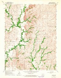
1964 Map of Laclede
USGS Topo · Published 1965About this map
Vermillion Creek dictates the geography of this part of Pottawatomie County, winding through a landscape defined by deep-set drainage patterns and prominent ridge lines. The small settlement of Laclede serves as a local focal point, supported by a Gaging Station along the creek that monitored the vital water levels of the region. For those researching family history, the map provides precise locations for three distinct burial grounds: Laclede Cem, Polly Creek Cem, and Vieux Cem. Several tributaries, including Pomeroy Creek, Indian Creek, and Lost Creek, carve through the townships of Center, St. Clere, and Emmett. The network of unimproved dirt roads and light-duty paths connecting these rural homesteads illustrates the isolated, agricultural character of the area in the mid-1960s.
Find a feature on this map
17 named features on this map. Tap any name to fly to it.
Don’t see what you’re looking for? This feature index may not catch every label — zoom into the map to look around manually.
Map Details
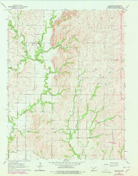
Editions of this 1964 Laclede Map
2 editions found
Other maps of this area

1889 · Wamego
USGS Topo · 1:125,000

1894 · Wamego
USGS Topo · 1:125,000

1953 · Wamego
USGS Topo · 1:24,000

1953 · Belvue
USGS Topo · 1:24,000

1953 · St Marys
USGS Topo · 1:24,000

1955 · Manhattan
USGS Topo · 1:250,000

1956 · Manhattan
USGS Topo · 1:250,000

1957 · Manhattan
USGS Topo · 1:250,000
1964 · Louisville
USGS Topo · 1:24,000
1964 · Onaga NE
USGS Topo · 1:24,000