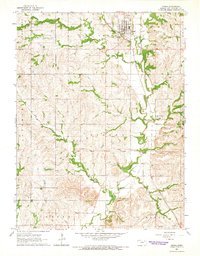
1964 Map of Onaga
USGS Topo · Published 1965About this map
Onaga serves as the primary hub of this 1960s landscape, situated at the intersection of the Union Pacific railroad and Mill Creek. The town is well-established with community infrastructure including a Fairground, a local Landing Strip, and a Sewage Disposal site. The surrounding terrain is organized into distinct areas such as Lone Tree, Sherman, and Vienna, reflecting the rural township structure of Pottawatomie County during this era.
Find a feature on this map
18 named features on this map. Tap any name to fly to it.
Don’t see what you’re looking for? This feature index may not catch every label — zoom into the map to look around manually.
Map Details
Editions of this 1964 Onaga Map
This is the sole edition of this map. No revisions or reprints were ever made.
Other maps of this area

1889 · Seneca
USGS Topo · 1:125,000

1889 · Wamego
USGS Topo · 1:125,000

1894 · Seneca
USGS Topo · 1:125,000

1894 · Wamego
USGS Topo · 1:125,000

1955 · Manhattan
USGS Topo · 1:250,000

1956 · Manhattan
USGS Topo · 1:250,000

1957 · Manhattan
USGS Topo · 1:250,000
1964 · Louisville
USGS Topo · 1:24,000
1964 · Onaga NE
USGS Topo · 1:24,000
1964 · Laclede
USGS Topo · 1:24,000