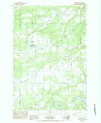
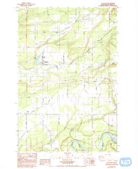
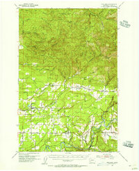
1984 Map of Onalaska
USGS Topo · Published 1984About this map
Onalaska stands as the central hub of this mid-1980s landscape, positioned near the lumber-era reservoir of Carlisle Lake. The terrain is defined by the complex drainage systems of the Middle Fork Newaukum River and the South Fork Newaukum River, which cut through the pastoral expanse of Alpha Prairie. To the south, the Cowlitz River winds through the bottomlands, bordered by Blue Marsh and the settlement of Salkum. This 1984 provisional edition highlights a rural economy tied to the land and water, featuring a Fish Hatchery and several storage bins. Local family names and early transit routes are preserved through labels like Gore Road, Deggler Road, and Beck Road, offering clear evidence of the historical property divisions and settlement patterns that established the communities of Ethel and Alpha Cemetery.
Find a feature on this map
39 named features on this map. Tap any name to fly to it.
Don’t see what you’re looking for? This feature index may not catch every label — zoom into the map to look around manually.
Map Details
Editions of this 1984 Onalaska Map
2 editions found
Other maps of this area

1916 · Chehalis
USGS Topo · 1:125,000

1941 · Olequa
USGS Topo · 1:62,500

1942 · Toutle
USGS Topo · 1:62,500

1943 · Willapa
USGS Topo · 1:62,500

1953 · Hoquiam
USGS Topo · 1:250,000
1953 · Toutle
USGS Topo · 1:62,500
1953 · Castle Rock
USGS Topo · 1:62,500
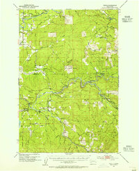
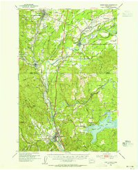
1954 · Onalaska
USGS Topo · 1:62,500
1954 · Centralia
USGS Topo · 1:62,500

1957 · Hoquiam
USGS Topo · 1:250,000