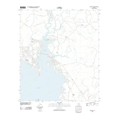
2010 Map of Onalaska
USGS Topo · Published 2010About this map
The Livingston Reservoir dominates this landscape, its western shores defining the development and recreation of Onalaska. This 2010 survey details a community closely tied to the water, where residential areas like Magnolia Park and streets such as Lakefront Dr follow the irregular contours of the shoreline. The map reveals the intricate network of inlets and branches, including Sank Branch and Robinett Branch, which feed into the primary reservoir body.
Find a feature on this map
49 named features on this map. Tap any name to fly to it.
Don’t see what you’re looking for? This feature index may not catch every label — zoom into the map to look around manually.
Map Details
Editions of this 2010 Onalaska Map
This is the sole edition of this map. No revisions or reprints were ever made.
Other maps of this area

1954 · Beaumont
USGS Topo · 1:250,000

1955 · New Willard
USGS Topo · 1:62,500

1957 · Beaumont
USGS Topo · 1:250,000

1958 · Livingston
USGS Topo · 1:62,500

1960 · Blanchard
USGS Topo · 1:24,000

1960 · Colita
USGS Topo · 1:24,000

1960 · Carlisle
USGS Topo · 1:24,000

1960 · Stephen Creek
USGS Topo · 1:24,000

1961 · Onalaska
USGS Topo · 1:24,000

1984 · Beaumont
USGS Topo · 1:250,000