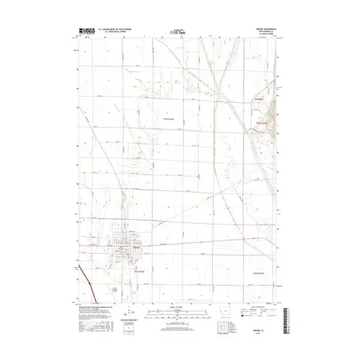
2015 Map of Onawa
USGS Topo · Published 2015About this map
Onawa serves as the primary hub of this Missouri River valley landscape, organized by a rigid grid of agricultural roads and drainage infrastructure. The town's layout features streets named for gemstones and materials, such as Diamond St, Ruby St, and Pearl St, reflecting a structured approach to its early 21st-century development. To the south of the town center lies Onawa Cem, while the Onawa Municipal Airport occupies the southwestern corner of the quadrangle.
Find a feature on this map
51 named features on this map. Tap any name to fly to it.
Don’t see what you’re looking for? This feature index may not catch every label — zoom into the map to look around manually.
Map Details
Editions of this 2015 Onawa Map
This is the sole edition of this map. No revisions or reprints were ever made.
Other maps of this area

1954 · Omaha
USGS Topo · 1:250,000

1954 · Fort Dodge
USGS Topo · 1:250,000

1955 · Sioux City
USGS Topo · 1:250,000

1955 · Fremont
USGS Topo · 1:250,000

1957 · Fremont
USGS Topo · 1:250,000

1957 · Omaha
USGS Topo · 1:250,000

1957 · Fort Dodge
USGS Topo · 1:250,000

1958 · Sioux City
USGS Topo · 1:250,000

1958 · Omaha
USGS Topo · 1:250,000

1958 · Fremont
USGS Topo · 1:250,000